This is Part 3 of a five part series on my little jaunt to Providence.
Warwick, Rhode Island. Saturday Morning, 0630h. My feet and I still aren’t on speaking terms, but since my internal clock is still running on Irish Time, I’m wide awake and ninety minutes later, after another great breakfast, I’m out of the door and inside the walkway to the airport terminal. The MBTA trains don‘t run on weekends (Booooo!!!!), and Amtrak doesn‘t serve T.F. Green Airport (Booooo!!!!), so it‘s bus only from now on, and those buses leave from the terminal building. Hey, at least the weather is better. Much better in fact, the sun is shining and there isn‘t a cloud in the sky. As for the buses themselves, all services running between the airport and Providence are operated by RIPTA, the Rhode Island Public Transport Authority. Somewhat surprisingly, at least for European minded travellers like me, RIPTA doesn‘t operate any ticket machines, or public transport counters at the airport. Even more surprisingly, you‘ll be looking in vain for any type of schedule or route network at the bus stop, let alone any electronic departure board. Granted, T.F. Green Airport is primarily aimed at US travellers who will probably stick to rental cars or services like Lyft. However, with Norwegian increasing their presence at the airport, and their services becoming more popular with European backpackers, this is something both RIPTA and the airport authority should seriously consider implementing before Norwegian kicks off their 2019 summer schedule from T.F. Green Airport.


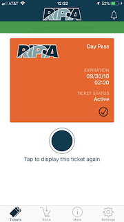
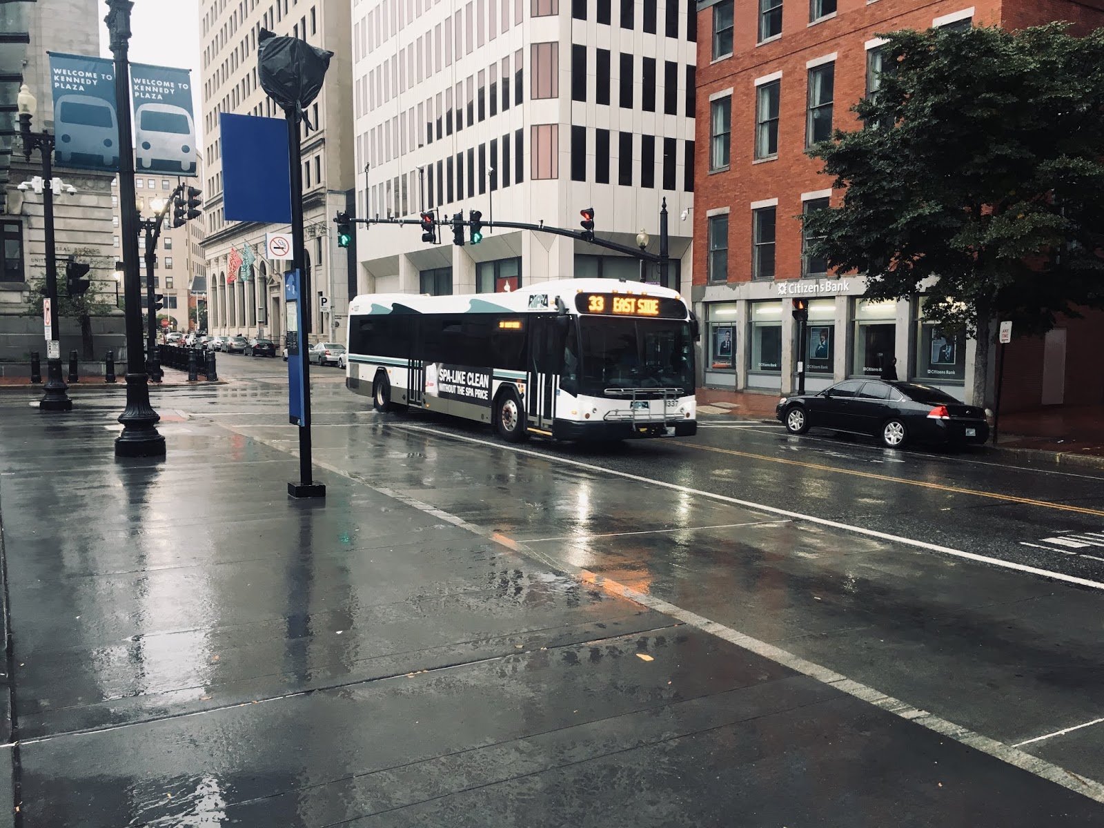
Now that this is out of the way, I do have to actually give a shout out to RIPTA in a more positive way. Their recently introduced FlashPass mobile phone app is ideal for visitors, as it enables you to buy your tickets ahead of time, for example while connected to a hotel or airport WiFi. Once purchased, you can activate the ticket at any time, without being connected to the internet, just by opening the app and tapping on the ticket. Once activated, you just need to show it to the bus driver, and you‘re good to go. See Bus Éireann, THAT‘S how you do mobile ticketing! As for the buses themselves, they take a bit of getting used to. Granted, they are modern and surprisingly comfortable, but their appearance is rather clunky. All the buses I end up getting are spotless, though, unlike what I‘m used to from Ireland, so that‘s a plus. At least, T.F. Green is properly served by public transport, with no less than five RIPTA bus lines serving the airport, in addition to long range buses by Peter Pan Bus Lines. THAT is how an airport should be served. Once on the bus, No. 14 service running between Newport and Providence, I get why they‘re so clunky. This service runs on the Interstate 95 between the airport and downtown, and the state of the road is absolutely atrocious! I‘m surprised that the bus doesn‘t shake itself apart on the way into the city. Then again, that explains the clunky design. The ride is pretty swift though, which is nice, and drops you off next to Burnside Park, right in the downtown area.
That in itself is a nasty surprise, as Burnside Park and Kennedy Plaza, the central bus interchange in Providence, are “home” to a large number of rough sleepers, as well as generally questionable characters. Granted, I know that the income disparity in the US is larger than in Europe, certainly in Western Europe, but I hadn’t expected the difference to be that big. Accordingly, I’m a bit more careful with my DSLR than I had originally anticipated. Hey, the iPhone has a pretty decent camera too, so why not use that?
Now, before I get into the details of my day, just a few facts about Providence itself. The city was founded in 1636 by Roger Williams, after he had managed to get himself booted out of the Massachusetts Bay colony. He’s actually quite an interesting fellow, and I’ll talk more about him in the next part of this travelogue. Located at the mouth of the eponymous Providence River, the city and it’s surrounding Rhode Island Plantation were actually the first colony to declare their independence from Britain, making the move on May 4th, 1776, a full two months before the other twelve colonies followed suit. Following the successful conclusion of the war, Rhode Island was also the last of the original colonies to ratify the Constitution of the United States, only doing so on May 29th, 1790. It’s history generally follows that of many other cities along the eastern seaboard, being dominated first by seaborne trade, then by heavy industry, before having to reinvent themselves around the turn of the millennium.
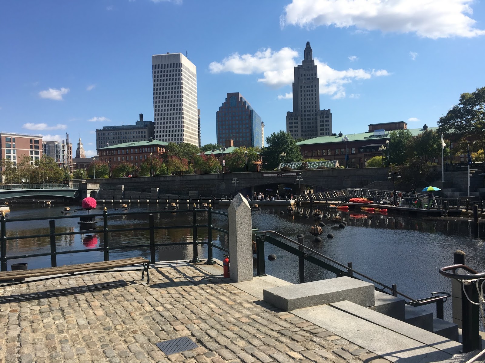
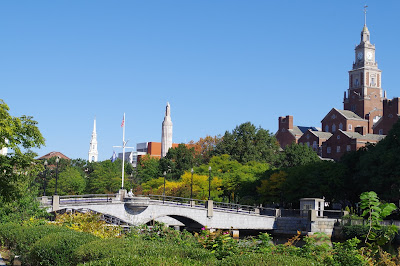
This is pretty obvious in the cityscape. The original site is now marked by the Roger Williams National Memorial, and North and South Main Street pretty much follow the historic spine of the city. The Downtown area sprung up during the industrial revolution and the “Gilded Age”, and its architecture represents that, while the area between Kennedy Plaza and the Rhode Island State House only really came about in its current form over the last thirty years, following the second closure and relocation of Providence’s train station. I’ll go more into depth on that in Part 4 as well. Anyway, this latest relocation made space for what is now Waterplace Park and the surrounding developments, as well as the local convention center, and the spectacularly unspectacular Providence Place Mall. As I said, I’ll get into detail on that later.
 |
| Maybe it's just the weather, but I think the Rhode Island State House just looks amazing! |
 |
| There's definitely something brewing in Station Park. |
Anyway, back to the story. Once I’ve found my bearings, the State House is my first destination. Built from 1895 to 1904, it is quite literally a symphony of marble. I may catch some flak for this, but I always find it a bit pretentious how seemingly every state capitol building appears to copy the capitol in Washington. However, in the case of Providence, standing, as it does, on Hill overlooking Downtown, surrounded by generous green spaces, it simply works. Plus, on a sunny day, the building just looks amazing, it’s marble almost too bright to look at. The rest of the area is equally good looking, having been completely remodelled. The resulting area, Waterplace Park, as well as the accompanying residential and business high rises is definitely something to be seen.
 |
| Waterplace Park is a recent creation, only built in the 1980s and 1990s. |
 |
| It straddles the Woonasquatucket River, and the round shape of the central pond seems to recall the circular cove that filled the space between Kennedy Plaza and the State House until the end of the 19th century. |
 |
| This little point marks the confluence of the Woonasquatucket and Mossashuck rivers. From here on until the Fox Point barrier, it's simply the Providence River. |
 |
| Getting a shot of the rather modest Providence skyline isn't easy around lunchtime! |
 |
| The entire area of what is now Waterplace Park used to be covered by the tracks of the old Providence Union Station. Only when a new, smaller Amtrak Station was opened in the late 1970s, was it possible to remodel and redesign the open landscape visible today. |
 |
| Some of the buildings were only completed recently. |
 |
| You can see the green copper roofs of the old Union Station buildings right behind Waterplace Park. |
One thing I notice immediately about the entire area is that it is a hive of activity. A stage has been set up on the steps of the State House, another one on the open grass area next to Providence Station, while food trucks are being moved into position along Finance Way. This is all a bit much for me, so I decide on a riverside walk through Waterplace Park and down to Waybaussett Neck. Here too, the activity continues, with boats of volunteers stocking a series of steel braziers in the middle of the river with wood. Parts of the riverside walkways are already cordoned off, although that isn’t enforced yet. Unfortunately, I don’t have a US SIM card, and data roaming charges are astronomical, so I can’t go online to find out what is going on until I reach a public Wifi. When I finally do manage to do so, thanks to Providence Place Mall, I find out that I’ve gotten lucky. Apparently, the last 2018 performance of WaterFire is on on exactly the weekend I’m in Providence. Now that’s a bit of real good news. It only starts at sundown though, so I still have quite a few hours until the whole shebang actually kicks off. So, it’s back to exploring providence.
 |
| Nope, that's not a postcard, and it hasn't been post processed either. That's really how beautiful the weather was. |
 |
| The Rhode Island School of Design stretches along the bank of the Providence River. Those structures in the center of the river are part of WaterFire, by the way. |
 |
| Further downriver, some of the braziers for WaterFire have already been filled. And those colours are just unreal. |
 |
| Waybausset Neck used to be the position of a narrow ford that separated the upper reaches of the Providence River from a cove that spanned much of today's downtown area, Waterplace Park and the current Amtrak station. Much of the downtown area actually sits on reclaimed land. |
 |
| I see the Royal Canadian Air Force are in town for exercises ;) |
The weird thing about the city is that there’s a large area of unbuilt open space immediately south of Downtown Providence. I’d noticed that the first time I checked the city out on Google Earth, as you do when preparing to travel somewhere. Some of this open area has been taken up by parks, but not everything. Turns out that, until a few years ago, this area was the course of the Interstate 195, a feeder for the larger Interstate 95, and which was realigned between Fox Point, the Jewellery District, and the junction with the I-95 to free up space within the city, a kind of mini “big dig” if you like. A side effect of this realignment is the “opening” of the Providence River all the way to its mouth. Or at least, that will be the case once the current construction work has finished. At the moment, construction is still ongoing for a pedestrian bridge at the southern end of the river, ironically tracing part of the path of the old I-195 by the looks of it. This construction work is currently also making the walk from Downtown to the Jewellery District a bit unpleasant, but once the gap between the two districts has been filled, it should really open up that part of Providence.
 |
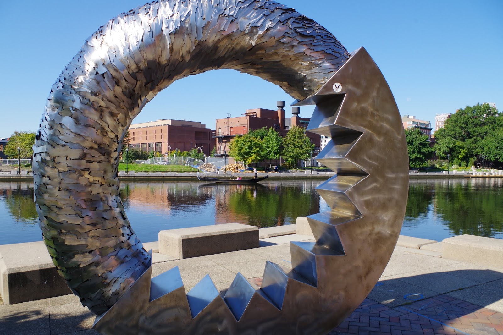
| Anyone know what this actually is? A Stargate in disguise? |
 |
| The Irish Famine Memorial at Waybausset Neck is a really great place just to relax for a bit. |
For me personally, a weird ring-shaped sculpture on the East bank of the river is as far south as I get. On the opposing side, I pop into a green area to rest my feet a bit, only to notice a very familiar flag. And a stone honouring the “heroes” of the 1916 Easter Rising. Yep, I’ve stumbled across Providence’s Irish Famine Memorial, and a very nice one it is indeed. Somber, but not depressing, yet stunningly beautiful in the right kind of weather, such as on this gorgeous Saturday. I’ll be the first to admit that I found all those “genuine Irish” souvenirs in Boston rather amusing, to put it mildly, however, none of that cheesiness appears present in this memorial, it just seems fitting. However, even down here at Waybaussett Neck, where the memorial is located, the preparations for WaterFire continue to be in full swing.
 |
| The skyline of Providence is really surprisingly compact. Still, almost every high-rise in the city dwarfs the Elysian in Cork, the highest building back here in Ireland. Just for reference. |
 |
| There's some lovely architecture around, mind you. |
 |
| In the small streets behind the financial district, Providence feels almost European. |
 |
| Really quite lovely. A few more shops and the area would be even more attractive. |
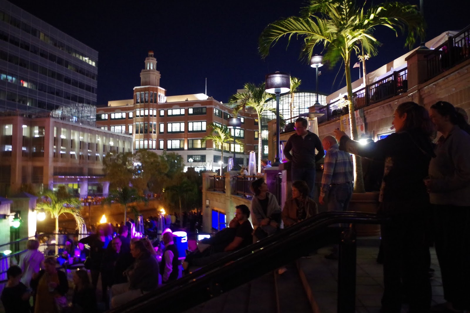
After a quick lunch break, I decide to check out the actual Downtown district of Providence. This entire area is surprisingly small, just as Providence itself is a rather compact city, something that is easily walkable. Or should be barring any unplanned treks through Boston that end up with your feet only communicating with you via letter. As it is, once you get past the one row of high-rises the city actually has, the buildings and streets become almost European, and I’m once again reminded particularly of areas like Heidelberg Neuenheim. What does come as a bit of a shock is the amount of empty stores and restaurants, although in fairness, there is quite the selection of quirky cafés, eateries, and shops, including some very enticing book stores. That’ll be something for later on in my trip. Right now, after checking out that area, I find myself meandering back to the Woonasquatucket River (try saying THAT three times fast!), where the WaterFire preparations are quite advanced by now. With less than two hours to go, I plonk my fat ass down on one of the stone steps at Waterplace Park, unknowingly picking one of the best spots in the house.
 |
| Crowds are gathering for WaterFire. |
 |
| Best seat in the house, undoubtedly! |
 |
| The sun is setting... |
Now what actually IS WaterFire? Well, Wikipedia describes it as a “sculpture”, which I guess is as good a term as any. WaterFire consists of eighty-six braziers positioned just above the waterline in the Woonasquatucket, Moshassuck, and Providence Rivers. At sunset, these braziers are lit in a carefully choreographed procession accompanied by music, and accompanied by dance and musical performances. I’ll let the pictures do the talking here, as it really is hard to describe WaterFire in words. You have to be there. The torch parade towards the end does leave me feeling a bit weird, as it hits close to home. This particular performance is dedicated to fighting breast cancer, and the torch parade at the end is made up completely of survivors and relatives of breast cancer victims. I’m not ashamed to say that I shed more than a few tears that night, but it is nonetheless beautiful. And, to be honest, it felt as if my parents were there with me. I'll just let the pictures speak for themselves.


The party may just be getting started in Station Park and along the rivers of Providence, but for me personally, the end of the torch parade is the sign to head back to the hotel. My internal clock still hasn’t fully adjusted, and by the time I return to my room, I’m dead tired, and quickly drift off to sleep.
That's all for Part 3 of this five part series. Don't forget to check out Part 4, which covers the "morning after" :)


Comments
Post a Comment